Carbon Storage Imaging
Better imaging improves decision-making
Reduce the risk of those decisions with our best-in-class seismic imaging technologies leveraged by HPC and digital sciences.
Whether leveraging new acquisition or vintage data, we assess containment risk and characterize the subsurface for modeling.

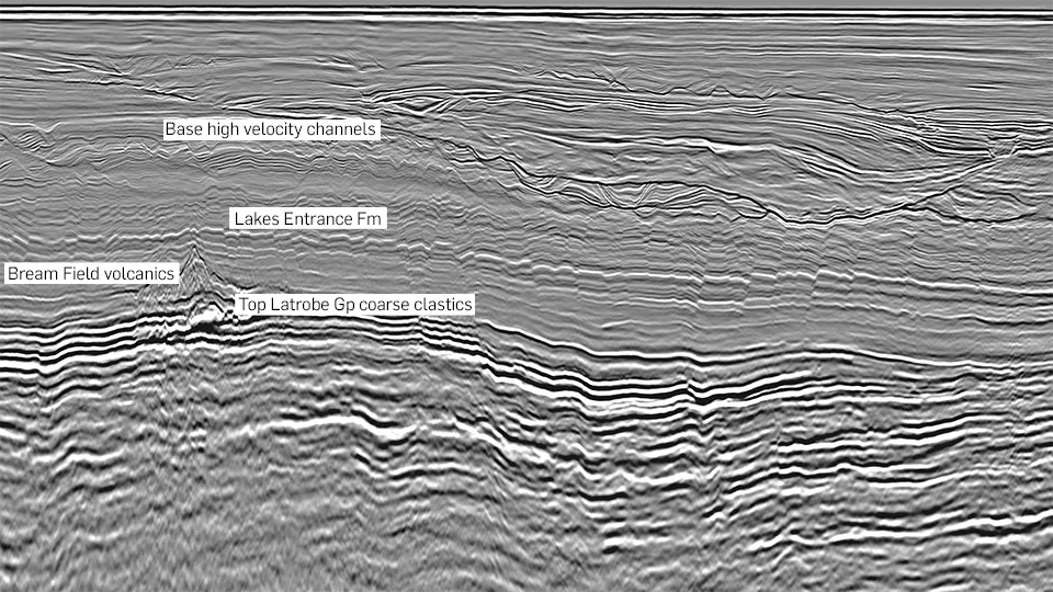
Gippland re-imaging highlights carbon storage opportunities in southeast Australia
New high-resolution Gippsland MC3D data provides unrivaled imaging from the central basin, deep into previously unexplored deep-water offshore areas. The data has provided enhanced detail and interpretation capabilities for existing fields, with potential to be re-purposed for CCS.
The new imaging demonstrates potential to identify and evaluate reservoir intervals and sealing units, and importantly, de-risk seal integrity and storage capacity for fields nearing or reaching their end of production cycle. This seismic example highlights the Bream Field within the previously well-explored shelfal offshore area, which is overlain and sealed by extrusive volcanics. These fields represent good candidates for carbon storage where new high-quality data can be used to effectively evaluate storage potential, unlocking new opportunities for energy transition solutions.
Adding carbon storage value to the Norwegian Continental Shelf
Using 3D Northern Viking Graben data we reveal carbon storage potential in the Horda Platform area and in proven saline aquifers of dry hydrocarbon prospects, such as the Stord Basin.
The high-quality NVG 3D data indicates great possibilities for storing CO2 in the Stord Basin. The spatial resolution maps the distribution of the sand-rich Hermod and Ty formations, including possible sand mounds. Amplitude data indicates a wide spread of Mid-Jurassic sands from tested prospects along the basin flanks toward the central part of the basin. The excellent imaging of faults provides a good basis for evaluating the sealing potential of overlying formations.

